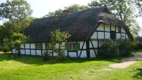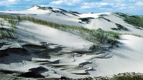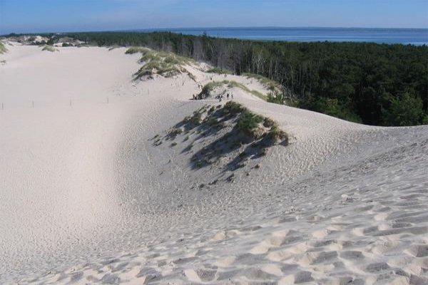

The largest area of the Park under strict protection, is the so-called Spit (3531 ha) with the most extensive fields of moving dunes in Europe. Strict protection also covers onesting areas of birds: Gackie Breeding Grounds, Żurnow Breeding Grounds, Gardneńskie Breeding Grounds, Klukowe Breeding Grounds and Stone Island on Lake Gardno with an area of 0.6 ha , as well as extensive areas of swamp forests and swamp birch (Kluki and Bory Torfowe), Poland's largest site of cloudberry - a post-glacial relict (Moroszka), a fragment of the old alder forest Olszyna, relict beech-oak forest Klukowe Buki and Lake Dołgie Małe. The park is located by the Baltic Sea on the central coast (Słowiński Coast), between Leba and Rowy. It encompasses the coastal lakes Łebsko - 7140 ha (the third largest lake in Poland) and Gardno - 2468 ha, as well as two smaller ones (Dołgie Wielkie - 156 ha and Dołgie Małe - 6,3 ha), the heavily swamped Łebsko Spit and a strip of sea coast up to the mouth of the Łupawa River. Above Lake Gardno is a high moraine dike (Rowokół - 115 m above sea level), descending eastward with steep slopes to the Lupawa River. The present area of the Park used to be a sea bay. As a result of the action of sea waves and wind, as well as the sand that was carried in, the bay was separated from the sea by the Gardeńsko-Lebska Spit. In this way, very shallow, muddy, surrounded by high reeds, built mainly by reeds, bulrush, water club and other vegetation, were created sea lakes Łebsko and Gardno. The Łebsko is approached by the Łeba River, and the Gardno by the Łupawa River. Both contribute significant amounts of pollution to the lakes. The lakes are shallow (Łebsko max. 6.3 m and average 2.6 m, and Gardno max. 2.6 m, with an average depth of 1.6 m). They are silting up at a rapid pace and are becoming further shallow and overgrown. Over the past 60 years, the area of Lake Lebsko has decreased by about 400 hectares. In the waters of the lakes there are often mass appearances (blooms) of algae, especially blue-green algae and green algae, which is a manifestation of excessive fertility and poor sanitary condition of the waters. Periodic inflows of sea water are characteristic of both lakes. The salt thus supplied makes life possible for numerous species of salt-loving plants and animals. In the central part of the Spit is the park's biggest attraction - the largest dunes in Europe, migrating at a speed of 5 to 30 meters per year, reaching up to 35 meters in height, with the largest dune field of 500 hectares. In places, the dunes receding from the west reveal cemeteries of trees, a remnant of sand-filled forests, and the outlines of ancient dunes covered with fossil soils. The shapes of the dunes are unstable, their forms constantly changing. The force of the migrating sands is so great that there is basically no obstacle for them to resist. Thus, forests and marshes fall, and history is also familiar with the fact that in the eighteenth century the entire settlement of Łączki near Leba was buried, whose houses have not been unwound to this day. The height of the Leba Spit varies from 0 to 56 m above sea level, with the highest elevation being the forested Czolpinska Dune, on top of which there is a lighthouse. The park has 140 km of marked hiking trails, led through the most attractive areas. In Leba, Czolpin and Rowy there are places to stay in hostels, hotels, guesthouses or in private accommodation. The park represents great ethnographic value. There are monuments of material culture of ethnic groups: Kashubians and Slavs, including buildings in the village of Kluki, where several Slavic families still lived after 1945. Among the more important monuments are also: ? a church in Gardna Wielka from 1282 (probably in Romanesque style) rebuilt in the 19th century. ? church of 1632 in Smoldzino. Other peculiarities of the park area include Mount Rowokół, 117 meters above sea level, located near the village of Smoldzino, where the Park headquarters and a natural history museum exhibiting the Park's flora and fauna are located. Branches of the museum are located in Rowy and Rąbka. To commemorate the centuries-old resistance of the Slavs to Germanization, the Park was given the name Slowinski. In 1977 it was recognized by UNESCO as a biosphere reserve, due to its exceptional natural values, including the presence of moving dunes, unique in Europe, and the eolian processes occurring here. In addition, the Slowinski National Park is covered by the RAMSAR International Convention on the Protection of Aquatic and Wetland Bird Habitats. Wybrzeże Słowińskie - a natural region in northern Poland, constituting the lowest, closest to the sea coast, part of the Koszalin Coast. It stretches in a narrow strip from Sarbinowo in the west to Karwia in the east. It covers an area of 1123 sq. km. The coast has a leveled character due to the activity of waves and the coastal sea current. The landscape is dominated by coastal dunes and marshes and coastal lakes, separated from the sea by spit dikes. These include: Lebsko, Gardno, Jamno (22.4 sq. km.), Bukowo (17.5 sq. km.) and Wiecko (10.59 sq. km.). The largest marshy areas surround Lakes Lebsko and Jamno and occur in the valleys of the Grabowa, Leba and Piasnica rivers (Bielawskie B這ta). The region is rather sparsely populated, with several fishing ports located in the mouths of rivers: Leba on the Leba, Ustka on the Słupia, Darłowo on the Wieprza. Numerous bathing beaches and resorts. In the central part of the region the Slowinski National Park was established. Vegetation The most characteristic of the park is the zonal arrangement of vegetation, which is a natural succession sequence that runs parallel from the seashore inland, and includes assemblages ranging from pioneer and initial sand communities to coastal crowberry forests. The flora of vascular plants counts about 850 species, 50 of which are under species protection. Algae can be found on the sandy seashore. On the winter beach, which is not flooded by the waters of strong autumn storms, the first pioneer plants appear: sea cress, sand honkenia. On the white dune there are common sand dune and sand blowfly, as well as the most beautiful plant of the coast - sea mynah. As you move inland, there are gray dunes covered by psammophilous grassland, dominated by gray brush and sand sedge. Further inland, clumps of crowberry and common heather appear, giving rise to pine crowberry forests. Plants characteristic of coastal forests include orchids. Pine coniferous forests, ranging from the driest, through various variants of fresh coniferous forest to swampy coniferous forest, occupy 80% of the park's forest area. Among the more interesting plant communities are extensive peat bogs of the high and transitional type, as well as low and meadow bogs. A total of 46 plant communities have been confirmed in the park. Animals Among vertebrates, the dominant group of animals in the park are birds, of which 257 species have been found in the park, including 150 breeding species. The richness of the avifauna is due to the diversity of natural environments and the park's location on the route of spring and autumn migration. The inaccessibility of the area means that birds find a place to nest or rest during migration almost all year round. The most valuable bird species include such species as white-tailed eagle, lesser spotted eagle, golden eagle, eagle owl, raven, swans and numerous species of ducks. Among mammals, deer, roe deer, wild boar, raccoons and hares are numerous.
04.07.2013