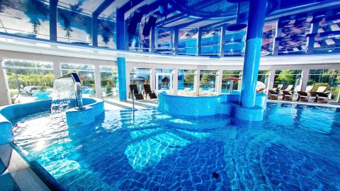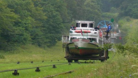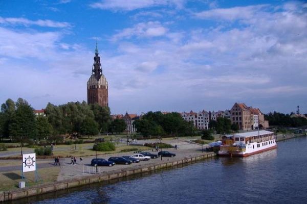
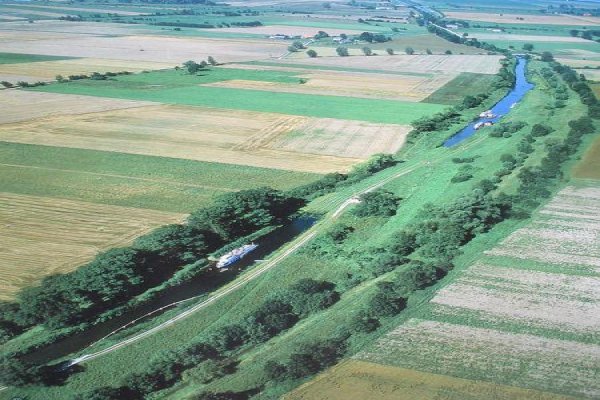
Elbląg Canal until 1945 Oberland Canal ? a navigable waterway in the Warmian-Masurian province. The canal is sometimes erroneously called the Elbląg-Ostróda Canal lub the Ostróda-Elbląg Canal. Physically and geographically, the canal is located in the macro-regions of Pobrzeże Gdańskie and Pojezierze Wschodniopomorskie, in the mesoregions of Żuławy Wiślane and Pojezierze Iławskie. The Elbląg Canal is the longest navigable canal in Poland. Its length is 83.3km. 43.82km - artificial canal, 39.48km - lakes. The total length of the canal with branches is 144.3km. The canal connects Lake Druzno with Drwęca and Lake Jeziorak. From Lake Druzno, through the Elblag River with the Vistula Lagoon and also through the Jagiellonian Canal, the Nogat and the Vistula with the Baltic Sea. Part of the Canal, from the sluice in Miłomłyn to Druzno Lake, is called the Warminski Canal. It has a length of 52 km and 5 slipways and 2 locks. In the construction of the Elbląg Canal, lakes lying at different heights between Ostróda and the Vistula Lagoon were used. The difference in levels reaches 100 meters. A peculiarity on a European scale is a set of 5 slipways, along which ships are rolled on special platforms set on rails. Several waterways branch off from the canal, including Ostróda - Lake Szeląg Mały, Ostróda - Lake Drwęckie - River Drwęca - Vistula. In the ninth century, small-scale industry began to develop rapidly in Mazury. Tabor pine, used for making masts and highly sought after by the boatbuilding industry, became world famous. The development of industry required the establishment of a communication network connecting Prussia with the Baltic Sea. Near Elblag, the shallow Drużno Lake, through which a 20-meter-wide navigable route was dredged, had already been adapted for navigation. A waterway connecting to the port of Elblag and further to the Baltic Sea led there. This condition influenced the concept of connecting the lakes lying between the Vistula and Pasleka. For many years no one came up with the idea of a solution to overcome the almost 100-meter difference in water level. The possible construction of locks would have required the construction of about 30 such hydrotechnical facilities. Work on the canal project began in 1837 and work began in 1844. The first four dry slipways: Buczyniec, Kąty, Olesnica and Jelenie were put into operation in 1860. The designer and builder of the Canal was Georg Jacob Steenke, who accepted the commission of Frederick II, who wanted to connect East Prussia with the Baltic Sea by a navigable route. During hydrotechnical works, the water levels in the reservoirs along the route of the canal were equalized. The levels of the water mirrors were lowered to the level of Jeziorak (99.5 meters above sea level). Such actions were the cause of lowering the water levels of several lakes by as much as more than five meters. An aqueduct was built on Lake Karnicki, (97.5 meters above sea level), above the water mirror level of the lake. In 1872-1876 - three more locks were put into operation: Miłomłyn, Zielona, Mała Ruś. The last slipway Całuny (located closest to Lake Drużno) was built in 1874-1881. The original concept for the construction of the canal was based on the project to overcome the difference in water levels between Lake Pniewskie and Lake Drużno by means of chamber locks made of wood. However, this concept was abandoned. The last Całuny slipway replaced the existing sluices. The reason for the change in concept was the prolonged sluicing time and problems with supplying water to the locks. The canal in the 19th century (1844-1860), as a transportation route, played an important economic role contributing to the development of the Ostróda and Iława lake districts and their communication with the ports of Gdansk and Elblag. The development of rail and automobile transport reduced freight transportation and by the 1930s it was only used by tourists. Currently, sailing ships of the so-called "White Fleet" are operated on cruises between the ports of Elblag and Ostroda.
05.07.2013